ORB International has been relying on gridded population sampling for over five years and continuously refining the process to maintain the methodological rigor while adjusting to the realities of conflict and fragile environments. Our primary consideration for planning any fieldwork is to ensure the safety of our team on the ground, who navigate a range of obstacles when travelling to complete a nationally representative study, from areas of active conflict to impassible road conditions.
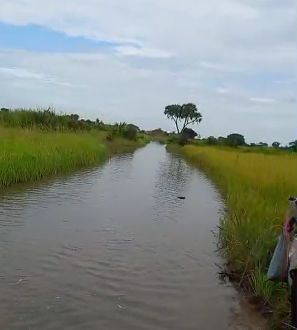
Figure 1: An inaccessible road passage to a PSU in Chad
Realistically, in some of the regions we work in, accessibility is severally limited. We regularly face the situation where only one town in the entire region might be accessible for the fieldwork, with rural areas/other territories under control of violent extremist organization (i.e. areas of Niger in Diffa and Tillabery region) or otherwise insecure (ongoing wars in Sudan). This means that the first thing that is needed before we even draw the sample from our gridded population sampling frame is to exclude subregional administrative units where fieldwork is not possible.
In Table 1 below you can see the results of this type of local review in Somalia – this allows us to draw the sample in accessible areas and minimize replacements of the specific locations selected for the fieldwork.
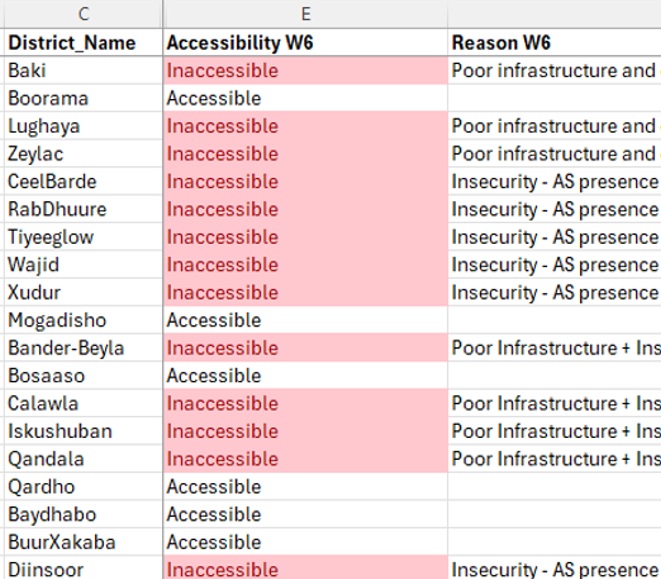
Table 1: Accessibility review in process
Once inaccessible areas are removed from the sample frame, ORB’s team draws the sample, normally drawing several times more locations than are ultimately needed to achieve the study’s sample size to allow for farther refinement for location viability, accessibility, and replacements during the fieldwork. This list is then shared with the local team who use Google Earth and local knowledge to exclude specific sampling locations within accessible districts – locations that interviewers cannot access due to recent conflicts (riots, attacks), extreme weather, or impassible roads. The map of Somalia in Figure 2 shows excluded areas demarcated by diagonal lines.
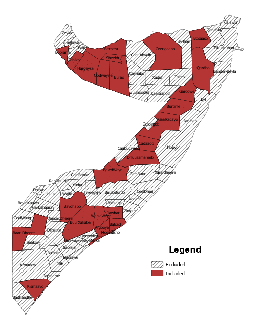
Figure 2: Accessibility map of Somalia
In a recent project in Niger out of a sample of over 1,700 locations, 435 were removed by our local team for conflict related reasons. Having this level of precision of what is accessible in the country, facilitated by gridded population methodology, has several major benefits:
- Increases transparency to our clients on the limits to ‘nationally-representative’ surveys in high-conflict environments and thus contributes to proper interpretation of data and enables thoughtful decision-making,
- Allows for post-survey probability of selection adjustments using weights, and
- Makes risk assessment an integrated part of project management and shared responsibility between ORB and our local team.
Ultimately, our goal is to maintain methodological consistency and rigorous sampling while prioritizing safety and security of the team on the ground, and procedures like accessibility review using gridded population sample are integral to successful projects in complex environments.